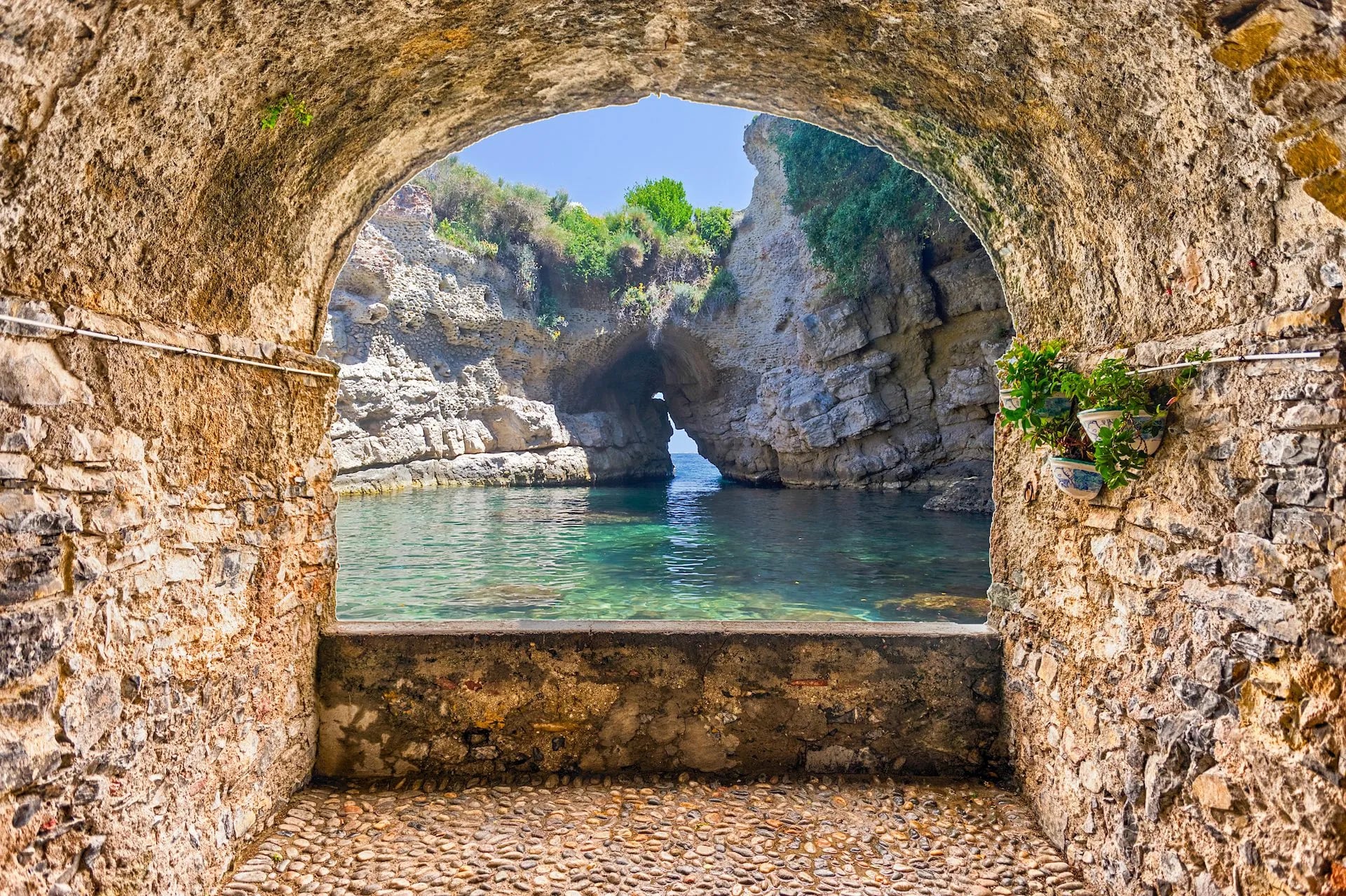
Walking the Amalfi Coast: 10 Best Walks From Amalfi to Capri
Ten walks from the Path of the Gods to Capri on the coast's numbered paths, each with its distance, climb, time and the bus or boat to the start, on one map.
Quick links
Don't want to read all this?
We've planned 2,000+ hiking trips. Send your dates, fitness and group size — we'll map the route and book every night.
Walking the Amalfi Coast means leaving the busy coast road for the stone stairways and mule tracks that linked its villages long before cars. They climb through lemon terraces and past ruined paper mills to cliff paths where the whole coast, from Positano to Capri, lies below you.
You can walk from town to town between Amalfi, Praiano and Positano on paths numbered by CAI, the Italian Alpine Club, but not along the shore. There is no path beside the sea from Positano to Sorrento.
These ten walks are 2 to 8.3 km long, with 180 to 680 m of climbing, plus one mountain route of 71.4 km. April to June and September to October are the walking months, and a bus or a ferry reaches every start.
The 10 Best Walks on the Amalfi Coast
These are the main Amalfi Coast walking routes. They start with the Path of the Gods, then work east through Amalfi's valleys and west again to Positano, the mountains, Punta Campanella and Capri. Each follows a numbered CAI path, and every start has a bus stop or a ferry pier.
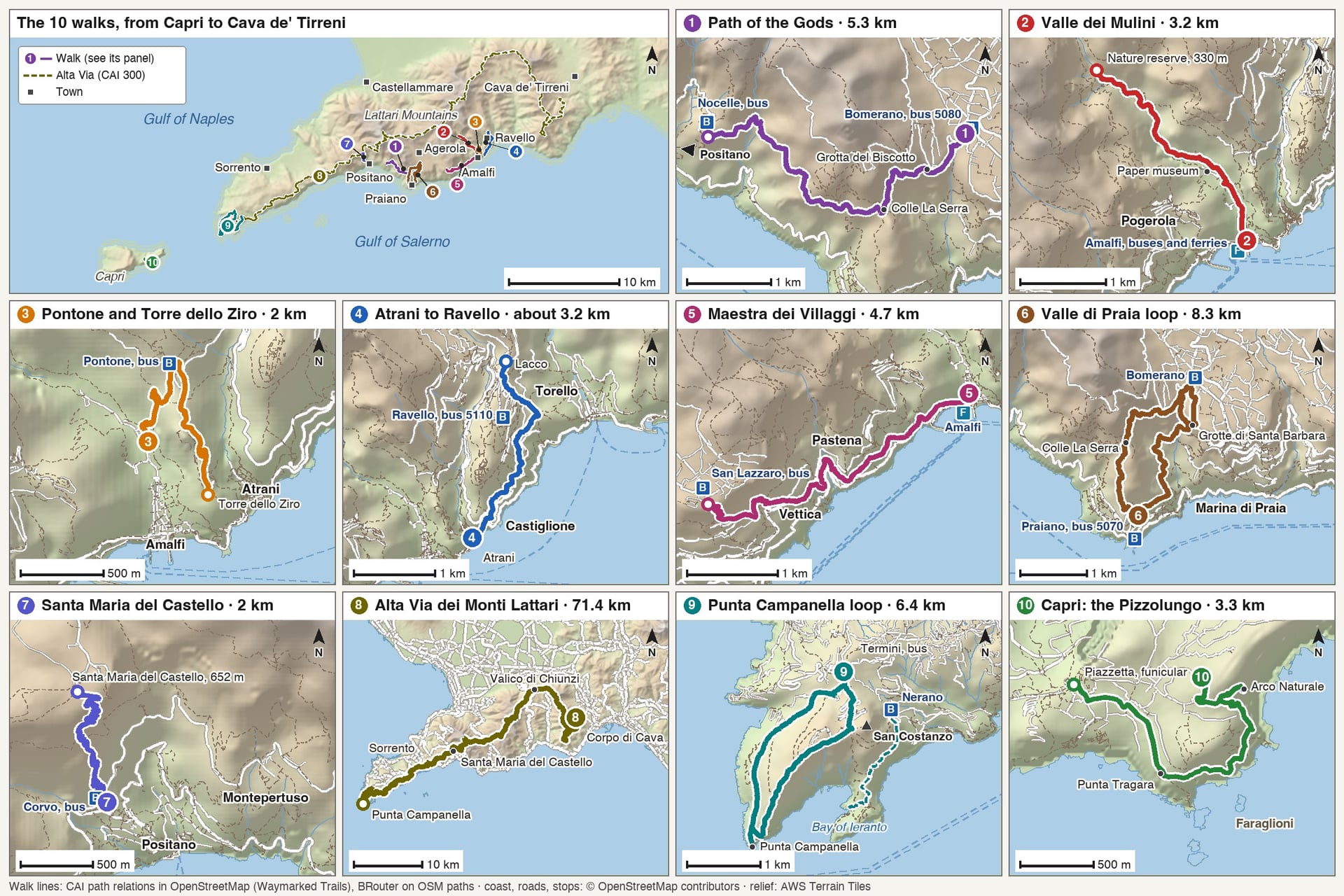
Walk | Distance | Elevation gain | Start | Bus or boat | CAI path |
Path of the Gods | 5.3 km one way | 184 m | Bomerano, Agerola | SITA 5080 from Amalfi | 327 |
Valle dei Mulini and Valle delle Ferriere | 3.2 km one way | 301 m | Amalfi | Amalfi buses and ferries | 325 |
Pontone and the Ziro Tower | About 2 km one way | About 330 m | Amalfi | SITA bus back from Pontone | 323, 351b |
Atrani to Ravello | About 3.2 km one way | About 370 m | Atrani | SITA 5120 out, 5110 back | 315 |
Maestra dei Villaggi | 4.7 km one way | 680 m | Amalfi | SITA 5080 back from San Lazzaro | 361 |
Valle di Praia loop | About 8.3 km loop | About 660 m | Praiano | SITA 5070 | 354, 327, 327b |
Positano to Santa Maria del Castello | 2 km one way | 424 m | Corvo, Positano | Local bus to Corvo | 333 |
Alta Via dei Monti Lattari | 71.4 km | About 4,460 m | Corpo di Cava | CSTP bus from Cava de' Tirreni | 300 |
Punta Campanella and Ieranto | About 6.4 km loop | About 420 m | Termini | SITA from Sorrento | 300, 339 |
Capri: the Pizzolungo | 3.3 km one way | 210 m | Capri town | Ferry, then funicular | 395 |
Choose by the day you have in mind:
Your first walk: the Path of the Gods, 5.3 km and mostly downhill, with Positano and Capri ahead
Short walks from Amalfi: the Valle dei Mulini, Pontone and Atrani to Ravello, each about 1 to 1.5 hours one way
Shade on a hot day: the Valle delle Ferriere, 3.2 km along the Canneto stream
A full day: the Valle di Praia loop or Punta Campanella, 3.5 to 4.5 hours
Several days in the mountains: the Alta Via dei Monti Lattari, 71.4 km, for experienced walkers only
1. The Path of the Gods
Start: Piazza Paolo Capasso in Bomerano, a village of Agerola at about 620 m
Distance: 5.3 km to Nocelle, above Positano
Elevation gain: 184 m up and 356 m down
Time: about 2 hours to Nocelle
Path: CAI 327, graded E (a hiking path)
Terrain: a stony mule track with steps, mostly unshaded, with unfenced drops after Colle La Serra
Getting there: SITA bus 5080 from Amalfi to Bomerano, about 40 minutes; local bus or steps from Nocelle to Positano
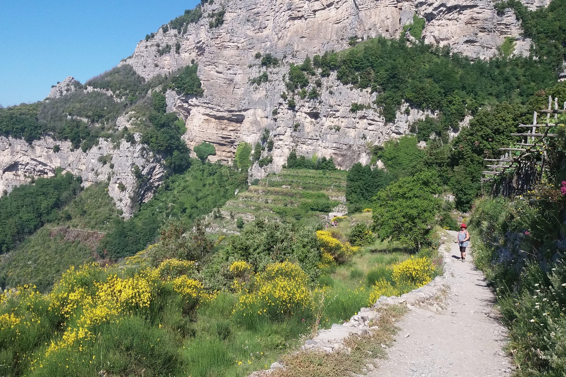
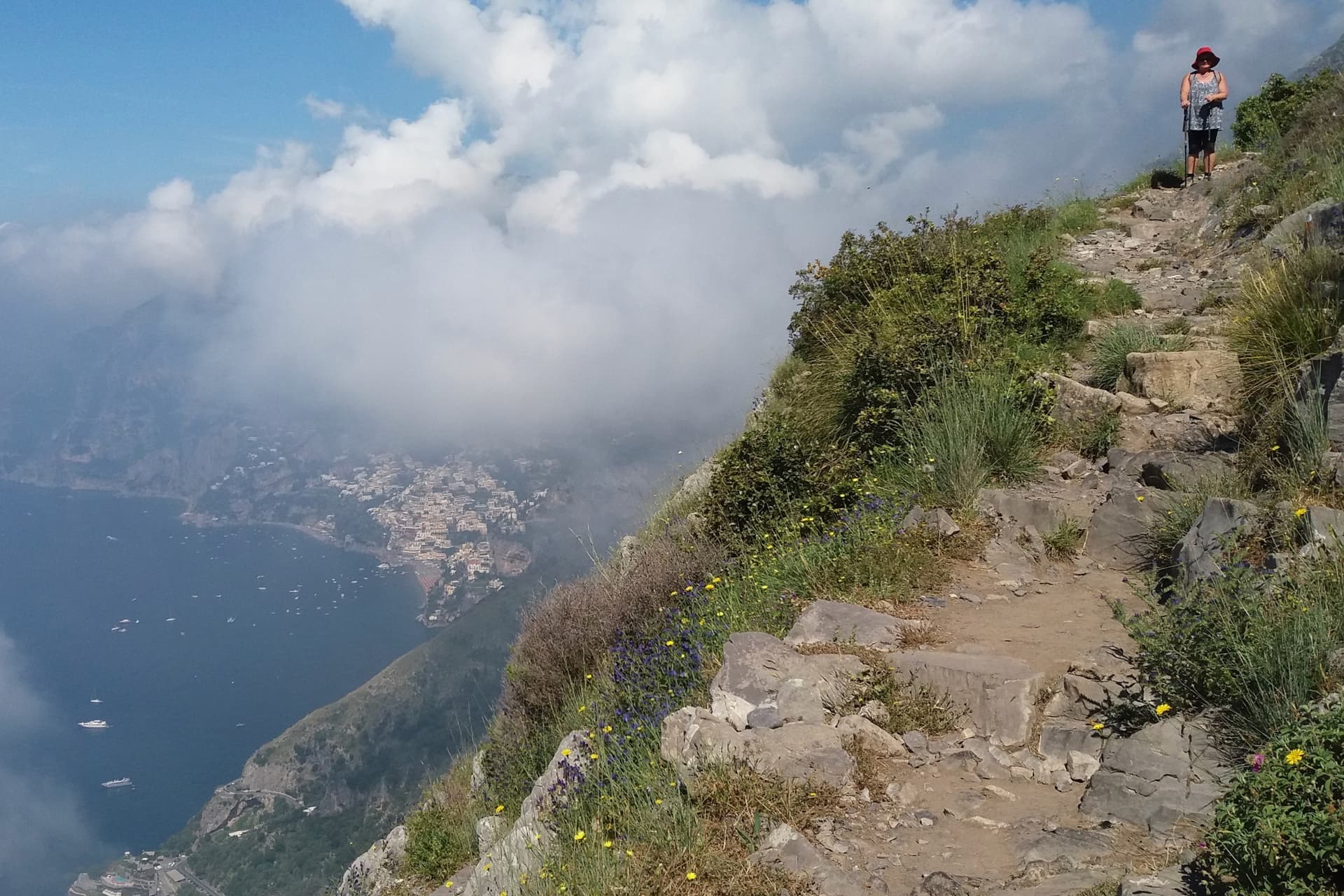
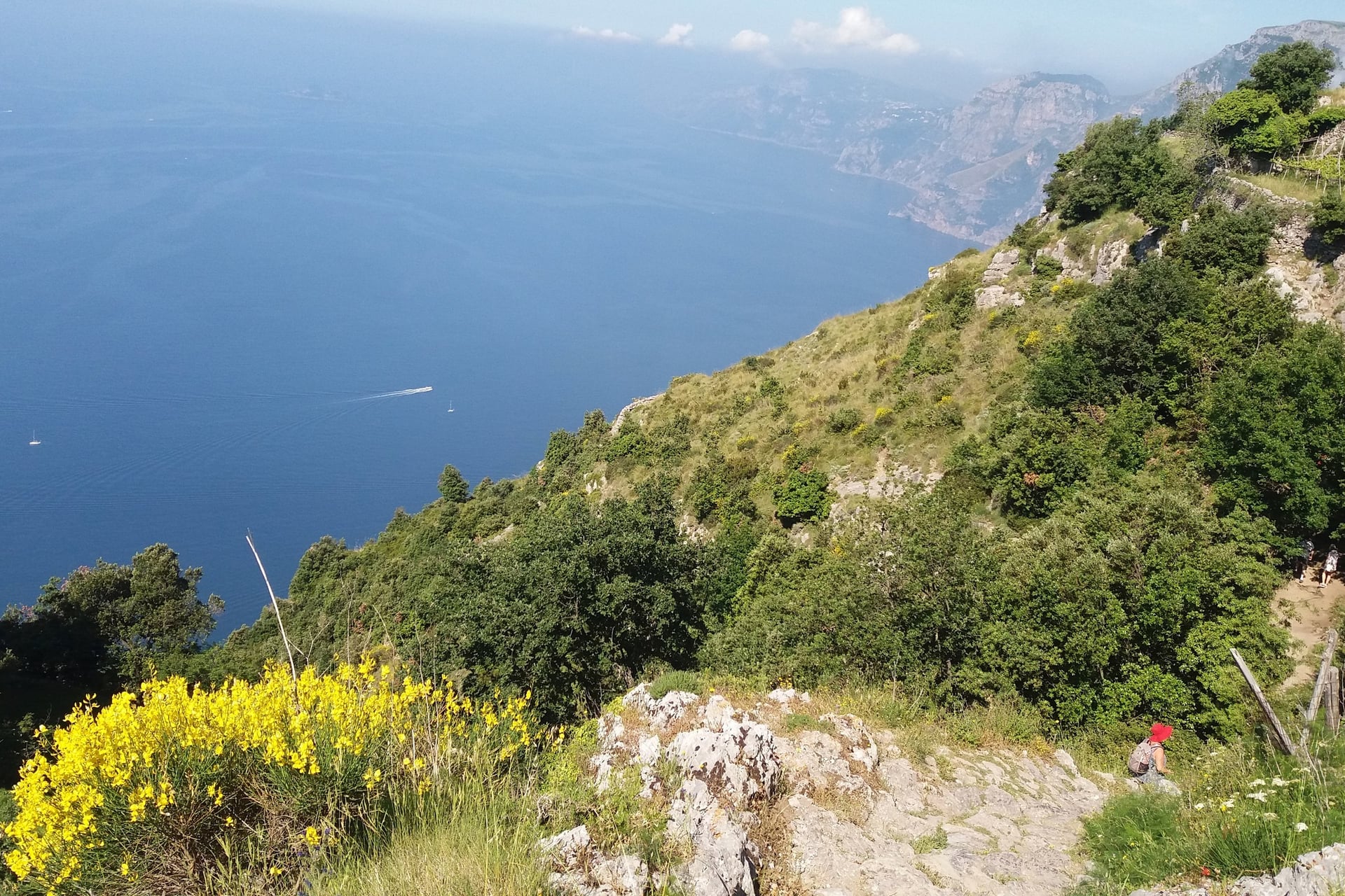
The Sentiero degli Dei is the walk most visitors come for. It follows an old mule track for 5.3 km along the cliffs from Bomerano to Nocelle, high above Praiano. Walked in this direction, it loses 356 m and gains only 184 m, with Positano and Capri ahead most of the way.
The highest point is the Grotta del Biscotto, at 630 m, and the path never drops below 437 m. At Colle La Serra, at 578 m, the path forks: the main line runs past unfenced drops, and the 327a variant runs a little higher for 1.3 km and avoids them. CAI suggests the variant for anyone who suffers from vertigo.
Water points are at Bomerano, Colle La Serra and Nocelle. The steps from Nocelle down to Positano take about 1 hour, and they are the hardest part of the Path of the Gods for the knees.
2. Valle dei Mulini and the Valle delle Ferriere
Start: Piazza Flavio Gioia, Amalfi's bus terminus and ferry pier
Distance: 3.2 km one way to the nature reserve
Elevation gain: 301 m
Time: about 1 hour up and 50 minutes down
Path: CAI 325, graded E
Terrain: lanes and steps past lemon terraces, then a woodland path beside the Canneto stream
Getting there: on foot from the harbour, or SITA bus to Pontone, 20 minutes, and path 323a down to the old ironworks
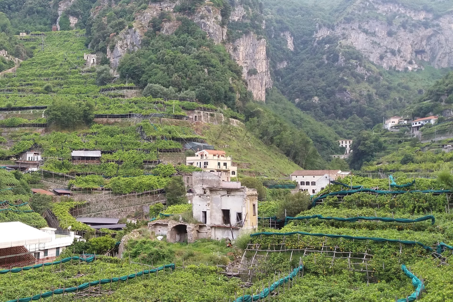
Behind Amalfi, the Canneto stream once drove the paper mills of the medieval republic. CAI describes the valley as an industrial zone that worked from about 1200 to 1800. The path climbs past paper mills, most of them now ruins, to the old ironworks at 244 m.
In town, the paper museum shows how Amalfi paper was made, inside one of the old mills. The ironworks above smelted iron from stone shipped in from the island of Elba.
At 330 m, a small reserve protects a waterfall and Woodwardia radicans, a fern that has grown here since before the last ice age. Entry is paid and booked with the Comune di Scala. A landslide closed the path in April 2022, and a bypass has made it walkable again since 2024.
3. Pontone and the Ziro Tower
Start: Via Salita dei Patroni, a stairway off Amalfi's main street, about 800 m above the cathedral square
Distance: about 2 km one way: 0.8 km of steps to Pontone, then 1.1 km to the tower
Elevation gain: about 260 m to Pontone, then 75 m up and 120 m down to the tower
Time: about 30 minutes to Pontone and 30 minutes on to the tower
Path: CAI 323, then 351b, both graded E
Terrain: a medieval stone staircase, then a narrow path through the ruins of a fortified town
Getting there: on foot from Amalfi; back from Pontone on the SITA bus, 20 minutes
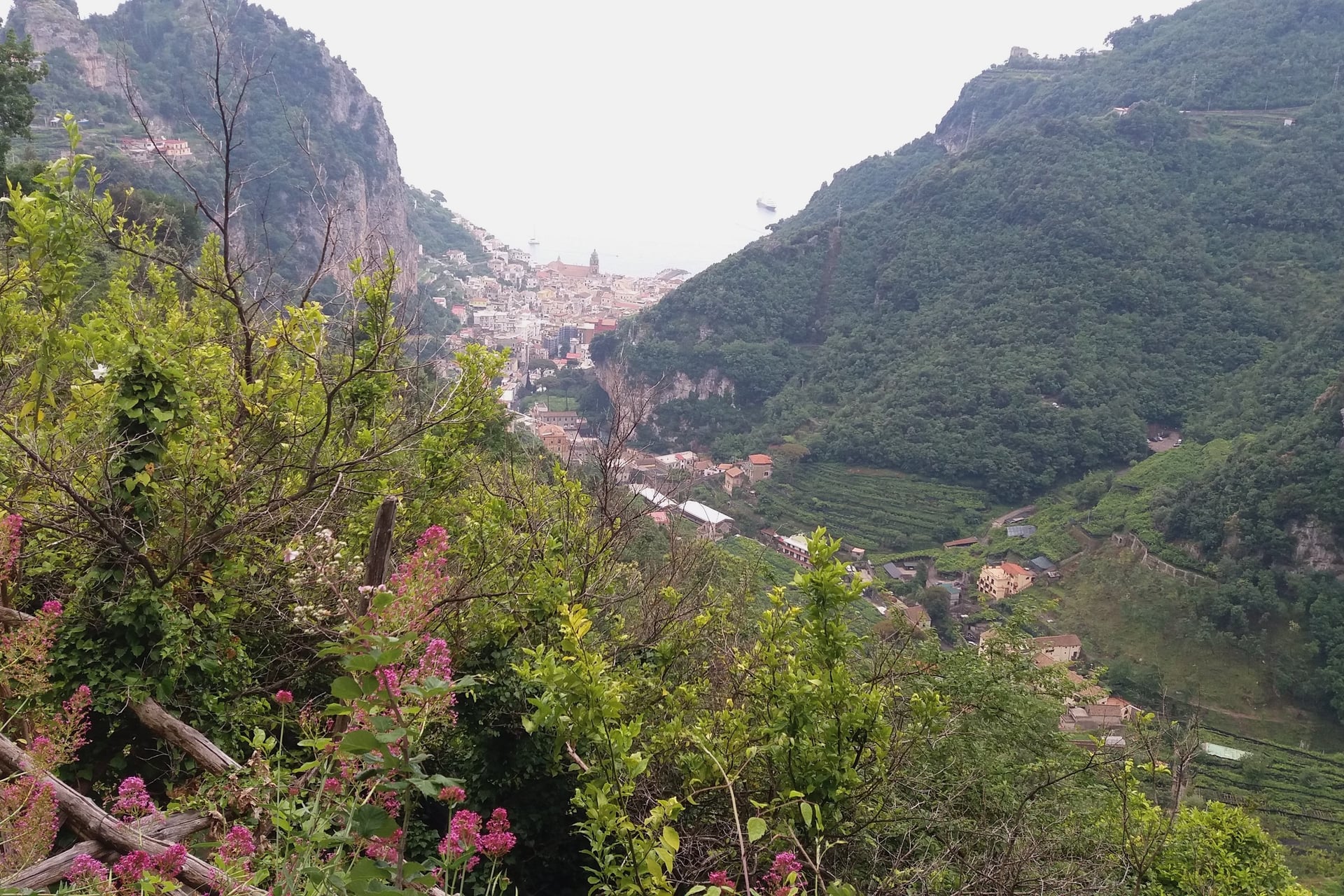
Amalfi's people climbed this staircase to take refuge from Saracen raids. It dates from the Duchy of Amalfi, between 839 and 1142. In about 30 minutes it is still the quickest way up to Pontone, a village of Scala at 274 m with a twelfth-century church on its square.
From Pontone, path 351b runs out through the ruins of a castle to a viewpoint at 264 m over Amalfi and Atrani. It then drops to the Torre dello Ziro, a fifteenth-century tower at 135 m.
The path ends at the tower, so walk the 1.1 km back to Pontone for the bus, or take the stairway down to Amalfi.
4. Atrani to Ravello on the Old Steps
Start: Piazza Umberto I in Atrani, about 700 m east of Amalfi
Distance: about 3.2 km to Lacco, at the top of Ravello
Elevation gain: about 370 m
Time: about 1 hour 30 up
Path: CAI 315, the first part of the path to Monte Cerreto, graded E
Terrain: stone stairways between houses and lemon terraces, with three short road crossings
Getting there: SITA bus 5120 stops above Atrani; back from Ravello on bus 5110, 25 minutes to Amalfi
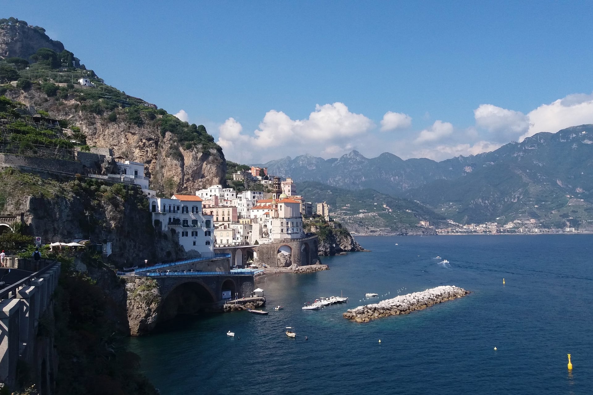
Ravello stands on a ridge about 350 m above the sea, and CAI path 315 climbs to it from Atrani's square almost entirely on steps. It passes the church of Santa Maria Maddalena, founded in 1274, and Castiglione at 98 m. Then it crosses the road and climbs through lemon terraces to Torello at 224 m and Lacco at 376 m.
Lacco is a short walk above the cathedral square and the gardens of Villa Rufolo and Villa Cimbrone. Take care on the road crossings, where the stairways meet traffic.
For the way down, take the old mule path past San Michele and the Carmine. It was the official road to Atrani until the 1930s, and the descent takes about 1 hour 30.
5. The Maestra dei Villaggi, Amalfi to San Lazzaro
Start: Piazza Duomo, Amalfi
Distance: 4.7 km
Elevation gain: 680 m up and 63 m down
Time: about 2 hours up and 1 hour 30 down
Path: CAI 361, graded T (an easy path), with signed detours
Terrain: an old stepped village road, with a section on the tarmac where the path is closed
Getting there: starts in Amalfi; back from San Lazzaro on SITA bus 5080
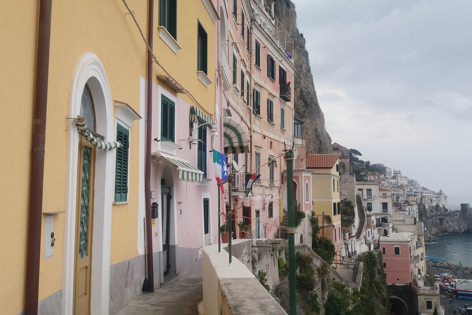
Its name means the main road of the villages, and it is still the stepped road that links Amalfi with its hamlets. From the cathedral square it passes the thirteenth-century Capuchin convent, now a hotel. Then it makes the biggest climb of any day walk here, 680 m in 4.7 km, through Pastena, Lone, Vettica at 200 m and Tovere at 397 m to San Lazzaro, a village of Agerola at 640 m.
Almost every hamlet has an old church, such as Santa Maria del Pino at Pastena, 96 m up, and Santa Maria Vergine at Lone, 157 m, built in 1204.
The path is open but interrupted. About 2 km out, near the church at Lone, CAI sends walkers on to the road round a closed stretch by Vettica's cemetery, and it reports other breaks, so check the CAI page first. At the top, Punta San Lazzaro looks down on Conca dei Marini.
6. The Valle di Praia Loop From Praiano
Start: the church of San Luca in Praiano
Distance: about 8.3 km loop
Elevation gain: about 660 m
Time: about 4 hours 30
Path: a village path into the valley, CAI 354 past the Grotte di Santa Barbara, then CAI 327 and 327b; graded E
Terrain: terraced valley paths, a steep climb to the caves, the Path of the Gods, then a long stairway down
Getting there: SITA bus 5070 to Praiano
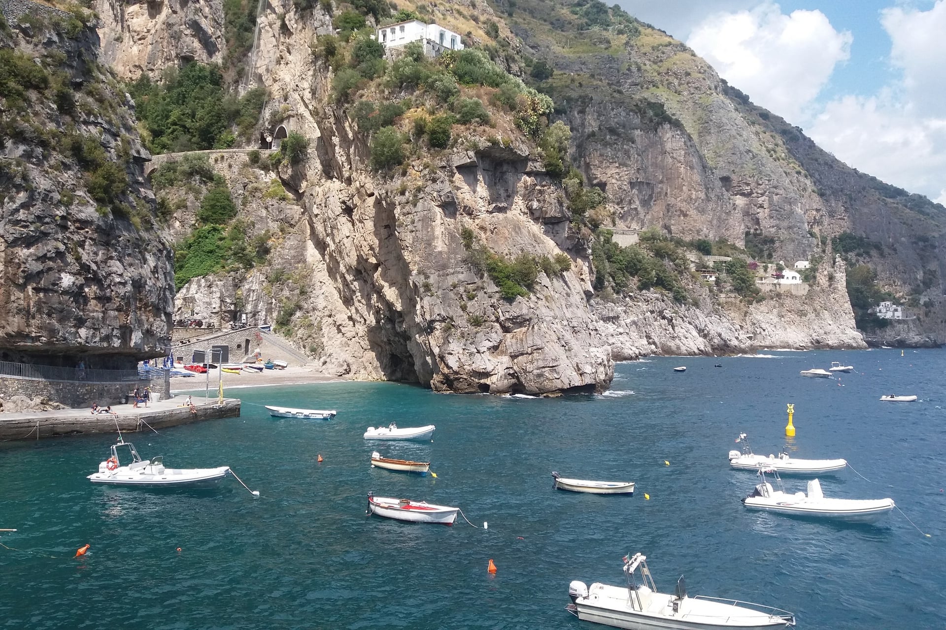
With this loop you walk the Path of the Gods from Praiano, without the bus to Bomerano. It heads east into the Valle di Praia, a quiet valley of terraces. Then it climbs steeply to the Grotte di Santa Barbara, caves at 506 m beside a ruined chapel, and on to Bomerano at about 600 m.
From Bomerano the loop follows the Path of the Gods west for about 1.8 km to Colle La Serra, at 578 m. There it leaves the path for the stairway of Via Colle La Serra, CAI 327b, which drops 301 m in 1.3 km to the upper part of Praiano, at 261 m: a steep descent at the end of the day.
7. Positano to Santa Maria del Castello
Start: Corvo, on the road from Positano up to Montepertuso, at 240 m
Distance: 2 km
Elevation gain: 424 m
Time: about 1 hour 20 up and 1 hour down
Path: CAI 333, Le Tese di Positano, graded E
Terrain: a long stairway up the slope above Positano, then woodland paths on the plateau
Getting there: local bus from Positano towards Montepertuso; back the same way
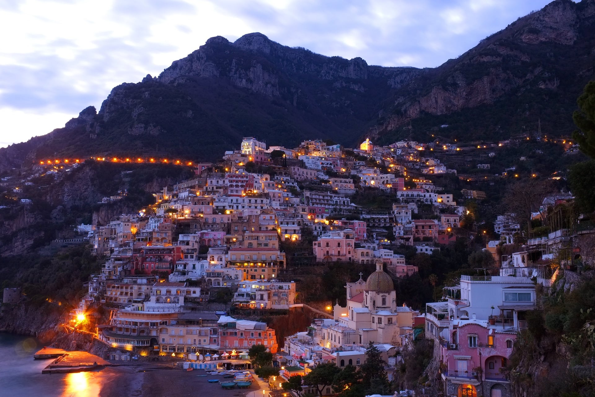
Positano's own climb starts at Corvo, at 240 m, on the road to Montepertuso. CAI path 333 takes a stairway up the slope behind the town. In 2 km it reaches the plateau of Santa Maria del Castello, a hamlet of Vico Equense at 652 m.
At the top the path meets the Alta Via dei Monti Lattari. On a clear day you look over the Gulf of Salerno on one side and the Gulf of Naples on the other.
Come back the same way, about 1 hour down. Path 331 through the Vallone Pozzo to Montepertuso, at 355 m, is graded EE, so leave it to experienced walkers.
8. The Alta Via dei Monti Lattari
Start: Corpo di Cava, by the abbey of the Santissima Trinità above Cava de' Tirreni
Distance: 71.4 km to Termini and Punta Campanella, in 11 sections
Elevation gain: about 4,460 m up and 4,720 m down
Time: about 29 hours of walking by CAI's times, so at least four or five days
Path: CAI 300, graded EE (for experienced hikers)
Terrain: ridge paths over limestone peaks up to 1,375 m, with stretches where the waymarks have almost gone
Getting there: CSTP bus from Cava de' Tirreni or Vietri sul Mare to Corpo di Cava; SITA bus back to Sorrento from Termini
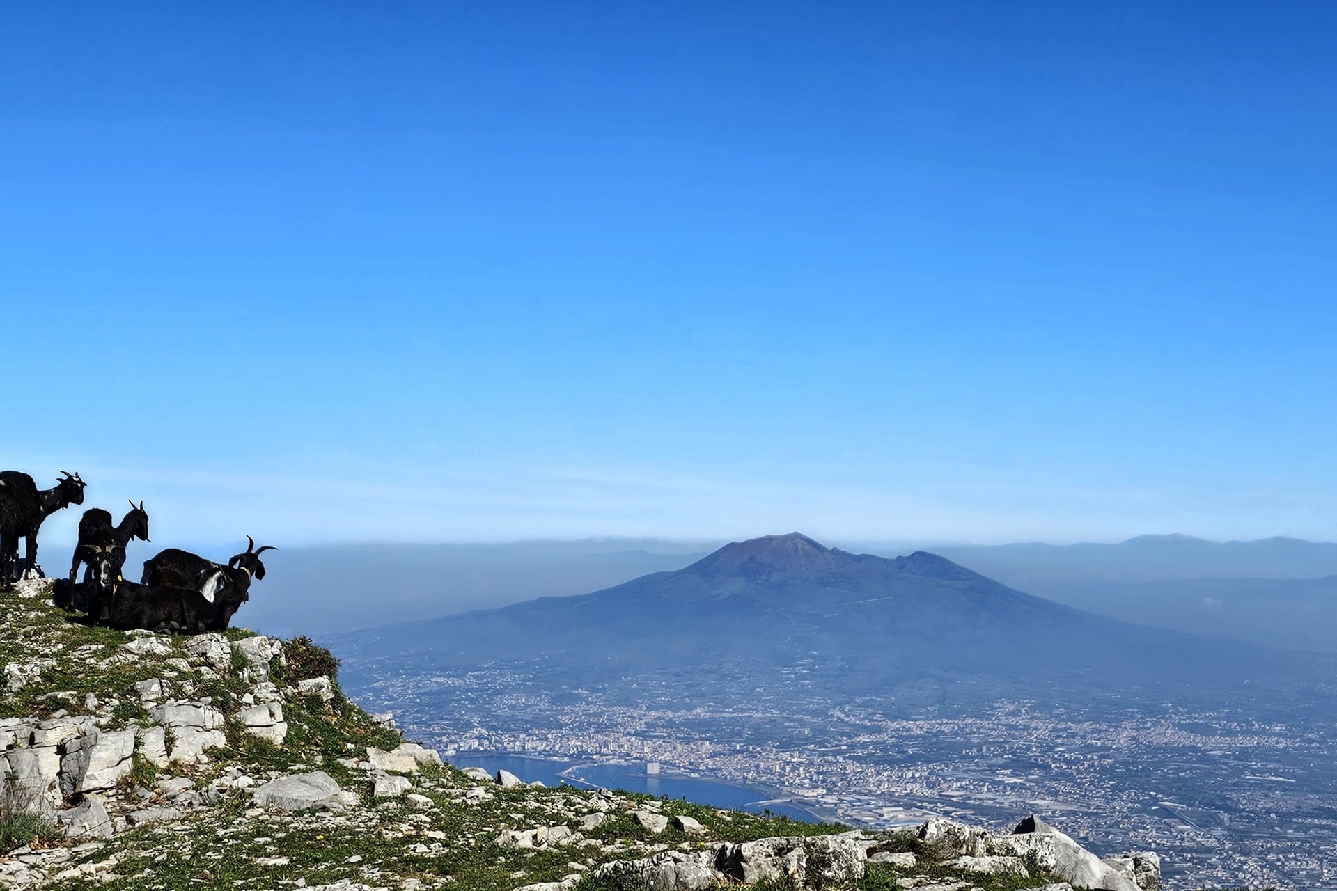
The Alta Via is the long-distance route of the Lattari Mountains. CAI path 300 follows the ridge for 71.4 km, from the abbey at Corpo di Cava, founded in 1011, to the tip of the Sorrento peninsula. It is a route for experienced mountain walkers only.
CAI splits it in two: 24.4 km and about 11 hours to Monte Cerreto, at 1,316 m, via the Avvocata sanctuary, then 47 km and about 18 hours to Termini.
West of Monte Cerreto it passes 200 m below Monte San Michele, at 1,444 m the range's highest summit, then drops to Santa Maria del Castello. The Valico di Chiunzi, at 650 m, has beds and food; elsewhere, plan your nights in the villages below the ridge.
CAI warns that the waymarks have almost gone between the Avvocata and the Foce di Tramonti, at 913 m, so carry the GPX tracks from the CAI Monti Lattari site and plenty of water. It also reports a growing landslide on the last stretch to Monte San Michele's summit, one of the Amalfi Coast hikes on our sister brand's list.
9. Punta Campanella and the Bay of Ieranto
Start: Piazza Santa Croce in Termini, at 320 m
Distance: about 6.4 km loop; Ieranto is about 2 km each way from Nerano
Elevation gain: about 420 m on the loop, and about 250 m back up from Ieranto
Time: about 3 hours 30 for the loop; about 45 minutes from Nerano to Ieranto
Path: the Alta Via (CAI 300) and the Roman Via Minerva; CAI 339 to Ieranto; graded E
Terrain: rocky paths over open scrub, and old Roman paving on the way back
Getting there: SITA bus from Sorrento to Termini, 40 to 45 minutes; Nerano is about 55 minutes
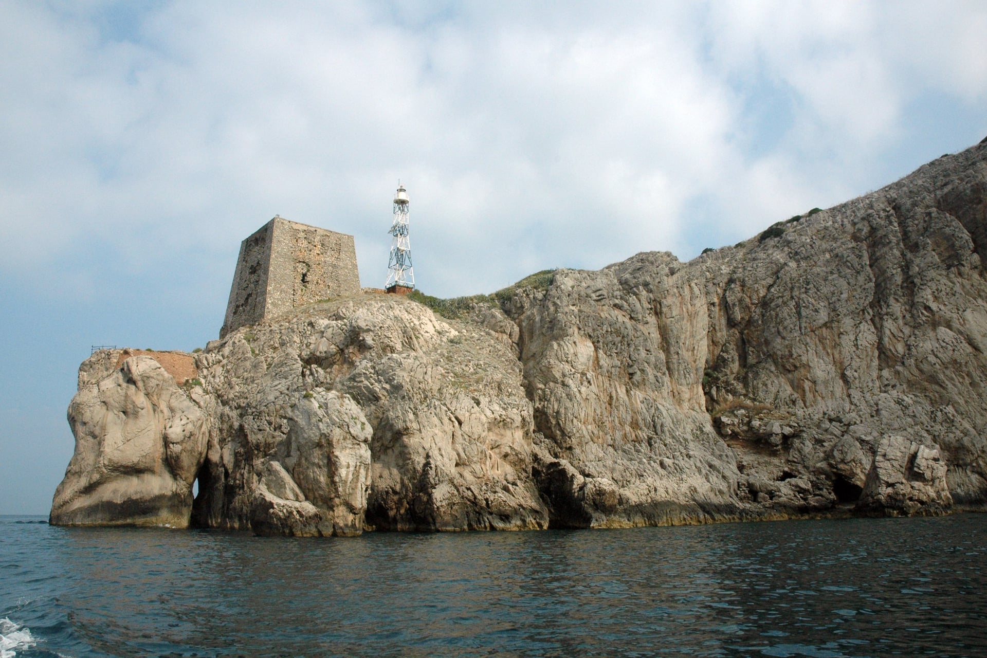
Punta Campanella is the tip of the Sorrento peninsula, with Capri across a narrow strait. The marine reserve's loop climbs from Termini to the chapel of San Costanzo at 485 m. It then crosses the wild south slope to the point, 36 m above the sea, where a temple of Athena once stood.
The way back is the Via Minerva, still partly paved with Roman stone, about 1 hour up to Termini. A rockfall closed it in November 2025, and Massa Lubrense reopened it in February 2026 after clearing the boulders, but the CAI page still shows the old closure.
The Bay of Ieranto, a former quarry given to FAI, Italy's National Trust, in 1987, is a walk of about 45 minutes from Nerano. FAI opens the bay from Tuesday to Sunday between March and October, and only at weekends from November to February.
10. Capri on Foot: Arco Naturale and the Pizzolungo
Start: the Piazzetta in Capri town, then Via Matermania out to the start of the path
Distance: 3.3 km
Elevation gain: 210 m, mostly on steps
Time: 1 to 2 hours
Path: CAI 395, Il Pizzolungo, graded E
Terrain: stepped and paved paths along the cliffs, slippery in the rain
Getting there: ferry to Marina Grande, then the funicular up to the Piazzetta
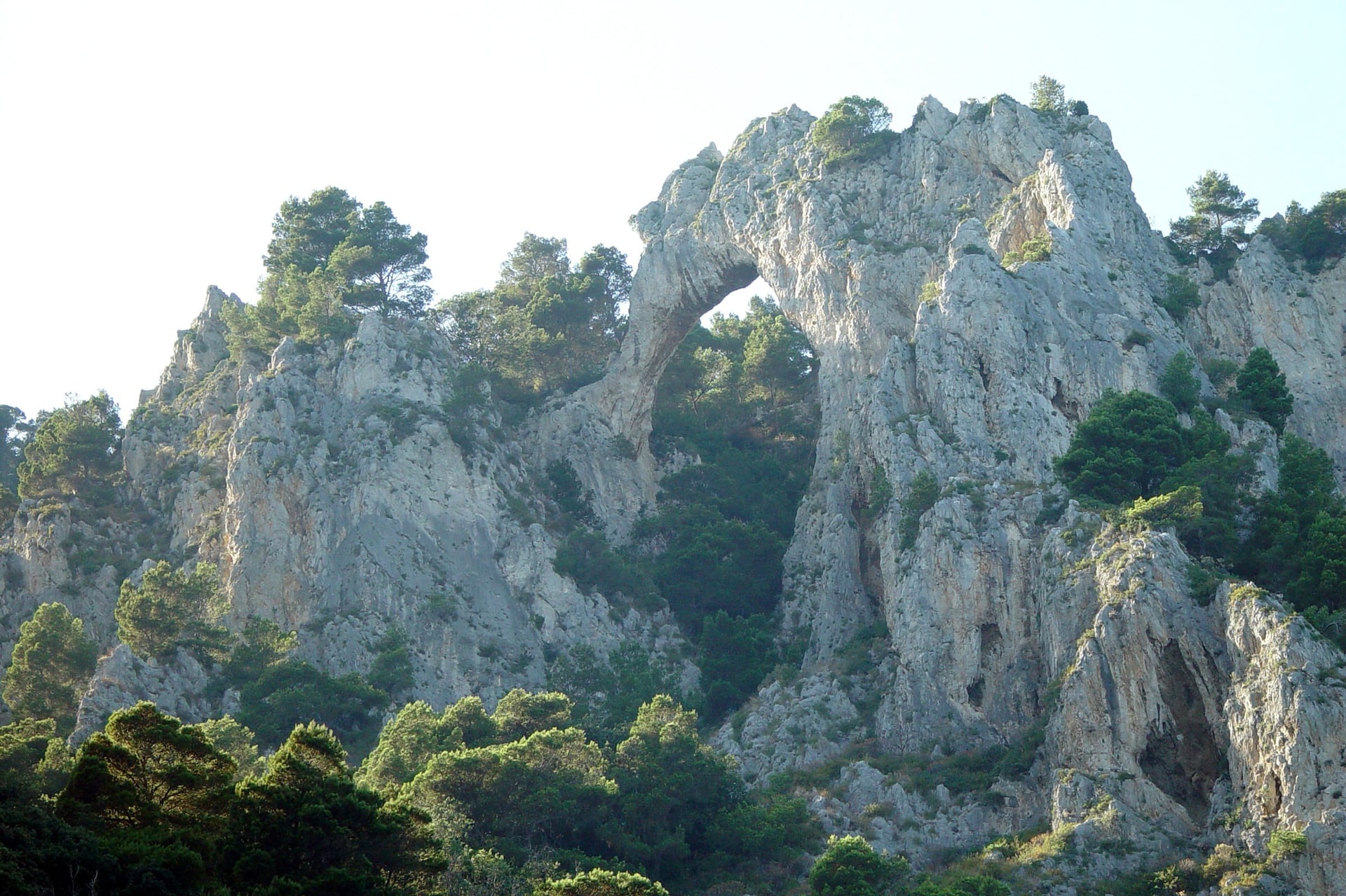
This 3.3 km walk leaves the crowds of the Piazzetta behind within minutes. Via Matermania leads out to the Arco Naturale, a limestone arch above the sea. Then the Pizzolungo path follows the cliffs south past the Grotta di Matermania, a cave used for pagan rites in Roman times, at 150 m.
Beyond the cave you pass Villa Malaparte on its headland and reach the Belvedere di Tragara, facing the Faraglioni rocks. Via Tragara leads back past the Certosa, at 96 m, to the centre.
From the Gardens of Augustus, Via Krupp zigzags down to Marina Piccola. It closes for repairs in winter and after rockfalls, and it reopened in April 2026 after winter repairs, so check that it is open before you plan a walk round it.
How Hard Is Walking the Amalfi Coast?
Most of these walks are graded E, an ordinary hiking path, but they are harder than their distances suggest. The effort comes from steps, heat and steep descents, not from scrambling.
Steps and Descents
Almost every walk here is made of steps, often worn smooth, and in villages such as Conca dei Marini even the lanes are stairways. The descent from Nocelle to Positano alone has about 1,700 steps, and going down is harder on the knees than going up.
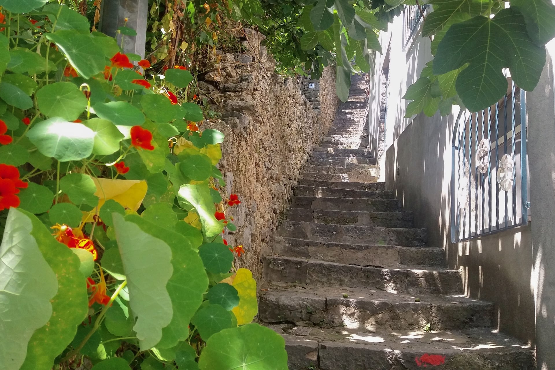
Walking poles help on the long stairways, and a firm, grippy sole matters more than ankle height. On a long day, take the bus up and walk down, or the other way round, to halve the steps.
Heat, Shade and Water
Heat is the main difficulty from June to September. At the Capri weather station the temperature reaches 30 °C or more on about 23 days in July and 26 in August, on the 1991 to 2020 averages. The south-facing paths have little shade.
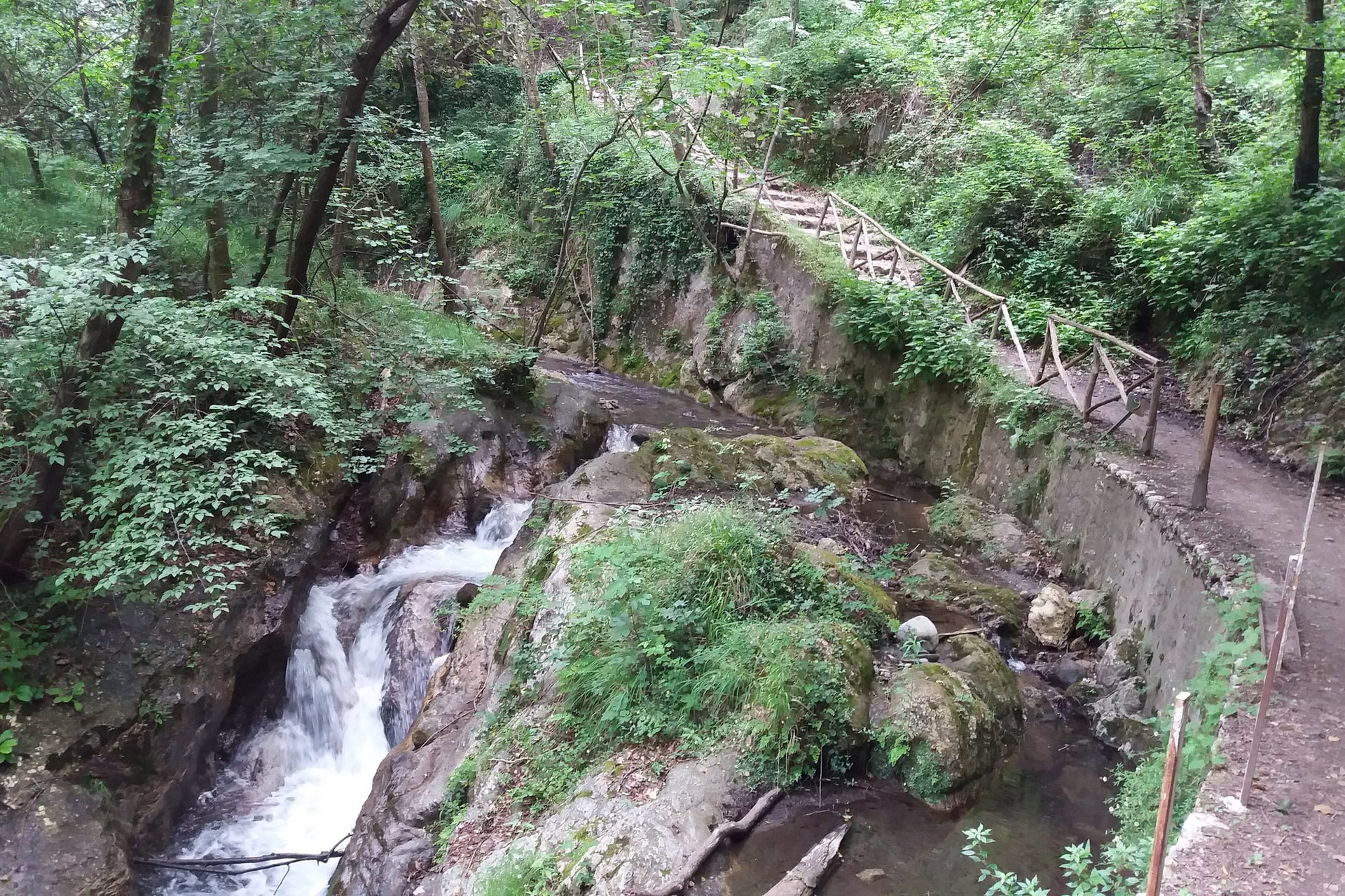
On hot days, start by 8 am and choose the valley walks: the regional park says the Valle delle Ferriere stays cool and damp even in high summer. Carry at least 1.5 litres of water a person, and refill at the fountains CAI lists for each path.
Grades, Waymarks and Closures
CAI grades each path T (an easy path), E (a hiking path) or EE (for experienced hikers, with exposed or hard-to-follow stretches). Paths carry red and white marks with the path number. The CAI Monti Lattari site gives each one a page, a GPX track and a status, OK or ALERT.
Landslides, rockfalls and fires close paths every few years. The Path of the Gods closed after the fires of August 2020, and the Via Minerva for more than 3 months in the winter of 2025 to 2026. In an emergency call 112, and on the Path of the Gods give the number on the nearest ceramic tile.
Best Time to Walk the Amalfi Coast
Through the year the heat on the open paths changes, and so do the ferry timetables and the hotels that are open.
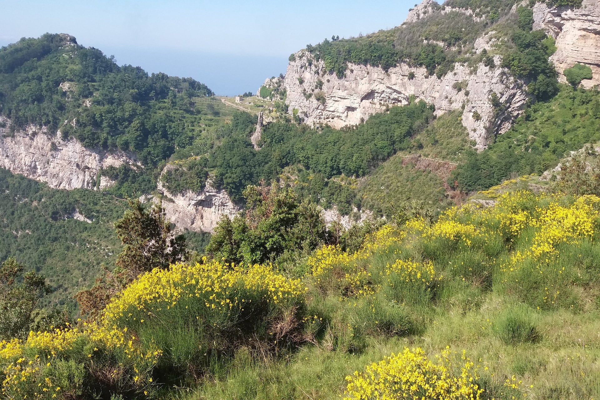
April to June and September to October are the walking months, and in early June the broom flowers along the Path of the Gods. Average highs at Capri are 19.8 °C in April, 24.4 °C in May and 23.5 °C in October, and days of 30 °C or more are rare outside June to September.
July and August average 31.7 °C and 32.4 °C, so walk at dawn or keep to the shaded valleys. In November it rains on about 9 days, and NLG's summer ferries along the coast stop in early November. Our month-by-month look at the best time to visit the Amalfi Coast adds sea temperatures, festivals and crowds.
Know Before You Arrive
None of the walks needs a car, and most of the planning comes down to bases, bus lines and a few tickets.
Getting There and Getting Around
Naples airport is the usual way in. The Curreri bus reaches Sorrento 8 times a day in 1 hour 15 to 1 hour 30, and Pintour shuttles run to Amalfi. From the USA, United flies non-stop from Newark and Delta from New York JFK in season, or you can fly to Rome and take the train to Naples in just over 1 hour.
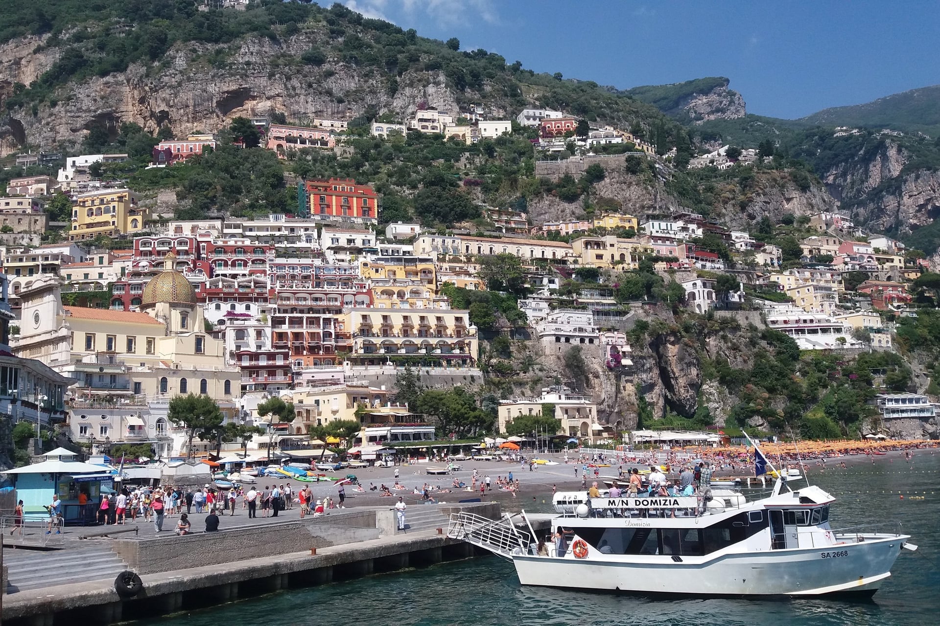
On the coast, Amalfi is the hub. SITA buses run from there to Positano and Sorrento (5070), Agerola (5080), Ravello and Scala (5110) and Salerno (5120), and Travelmar ferries link Amalfi, Positano and Salerno. Tickets bought on board cost more than those from a tabacchi or the UnicoCampania app.
Driving does not help. From 10:00 to 18:00, cars may use the coast road only on alternate days by number plate: at Easter and around 1 May, at weekends from June to October and every day in August and September. Every line and timetable is in our guide to getting around the Amalfi Coast.
Where to Stay for the Walks
Moving base as you walk west saves long bus rides, and each town suits a different group of walks.
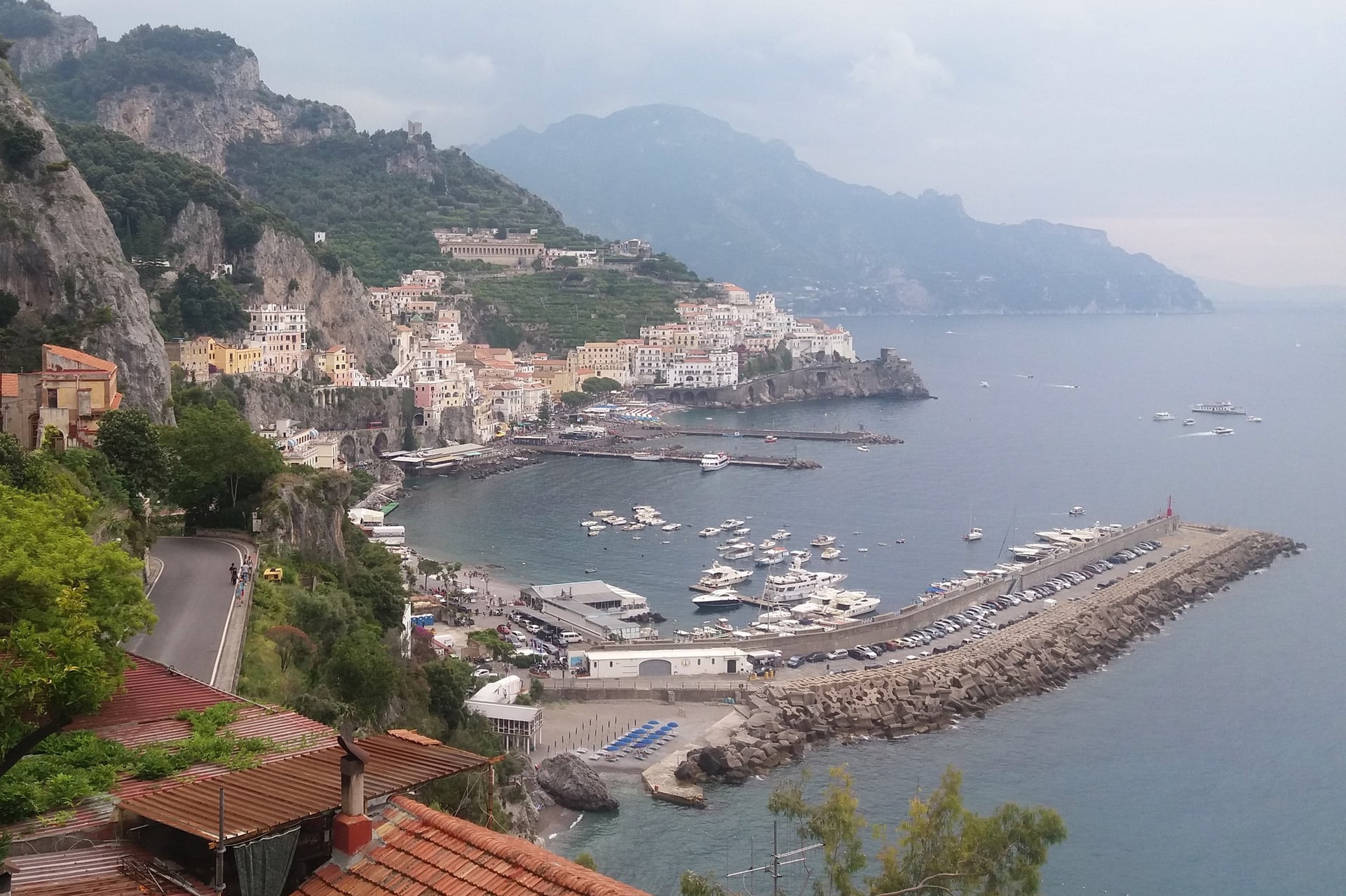
Amalfi: the hub for every SITA line and the start of walks 2, 3, 4 and 5
Praiano: for the Path of the Gods and the Valle di Praia loop, on bus line 5070
Agerola: a cooler village at about 630 m, at the start of the Path of the Gods
Positano: for Santa Maria del Castello and the end of the Path of the Gods
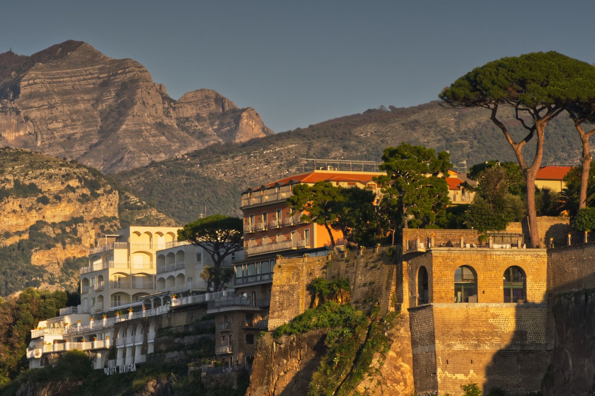
Sorrento: for Punta Campanella and Capri, with trains to Naples and ferries to the island
Most hotels in Positano and Amalfi close from late November to mid-March, so outside the season book a base that is open before you plan the walks. In the evenings there are the things to do on the Amalfi Coast, from Ravello's gardens to the beaches.
How Much It Costs
The paths themselves are free. The costs are buses, boats and a few entry tickets, at 2026 prices:
SITA buses: €1.60 to €3.60 a ride on the coast, by distance; the COSTIERASITA 24-hour ticket is €10
Ferries: Travelmar €10 from Amalfi to Positano and €12 from Salerno to Amalfi; NLG €22 from Sorrento to Capri
Capri landing contribution: €5 from April to October and €2.50 in winter
Valle delle Ferriere reserve: €5
Paper museum, Amalfi: €4.50
Ravello gardens: €8 for Villa Rufolo and €10 for Villa Cimbrone
Capri: €2.50 for the Gardens of Augustus and €15 return on the Monte Solaro chairlift
Tourist tax: €3 a night in a 3-star hotel in Positano, from 1 April to 31 October
What to Pack
Stone steps, strong sun and cooler mountain villages set the kit, whatever the month. On stony tracks such as the Path of the Gods, grip and sun protection matter more than warmth from May to October.
For any walk:
Trail shoes or light boots with a grippy sole for worn steps
A 20 to 25 litre day pack with a light rain jacket outside summer
A sun hat, sunglasses and sun cream
A phone with offline maps and the CAI GPX tracks
For the Amalfi Coast:
Walking poles for the long stairways down
At least 1.5 litres of water a person, more in summer
A warm layer for Agerola and the ridges, which are cooler than the coast
A bus ticket bought in advance, as tickets cost more on board
Swimwear for the coves at the end of a walk, such as Marina di Praia and Ieranto
Which Week, or Day Walks From One Base?
Most of these walks link up into a week, west along the coast from Amalfi, but only if each night is in the right place.
From one base you are tied to the buses, which can be full in summer, and to the same ride back every evening. Moving west with the walks puts you in Praiano before the Path of the Gods and in Sorrento before Punta Campanella. Your luggage then has to follow you up and down the steps.
We solve that on our self-guided walking holidays: we book 3-star hotels in the right villages and move the luggage between them. Three weeks fit most trips:
Five days: Best of Amalfi Coast, Amalfi to Positano, 36.1 km over three walking days, with the Valle dei Mulini, the Maestra dei Villaggi and the Path of the Gods
Eight days: Amalfi Coast and Capri Island, Amalfi to Positano, 67.9 km over six walking days, adding the Valle delle Ferriere, the Valle di Praia loop and Capri
Eleven days: Amalfi to Sorrento, 87.1 km over eight walking days, adding Santa Maria del Castello, Punta Campanella and a day on Capri from Sorrento
All three run from April to November and include hotels with breakfast, luggage transfers, a digital guidebook, a GPS app and support; the tourist tax is paid locally. Ask us about dates for next season.
The long week ends on Capri, the island that sits ahead of you along the Path of the Gods, with a last walk past the Arco Naturale to the Faraglioni.
Frequently Asked Questions
Plan with a hiking expert
Free advice from a team that knows these routes inside out - real people, not a bot

Hassle-Free
We handle itineraries, accommodations, and anything else you prefer not to deal with, so you can enjoy a carefree hike.

Book With Confidence
We are a financially protected company, fully bonded and insured, keeping your money safe and allowing you to travel with confidence.

Tried & Tested Adventures
Only the best walking holidays on the Amalfi Coast, cherry-picked by our local team with an in-depth knowledge of the region.

Unbeatable Support
Our 24/7 customer support is where we show our passion, bringing you a better experience by making your well-being our number one priority.